Mention the word “Borjomi” anywhere in the Caucasus region and you’re likely to get an aggressive response – either an emotional display of support, or a disgusted gesture of rejection.
This has nothing to do with the region, though – it has everything to do with the celebrated (and equally shunned) mineral water, also known as Borjomi. (Some Georgians claim allegiance to Nabeghlavi mineral water, much like Americans are split between Pepsi and Coke or Budweiser and Miller).
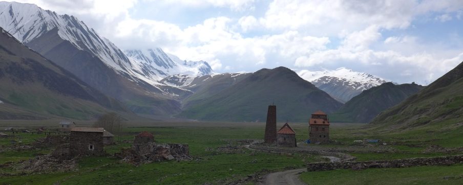
Although best known for this salty, carbonated mineral water, Borjomi and the surrounding region is quickly regaining the fame it once enjoyed for its natural pleasures.
Dating from 1829, Borjomi occupies a beautiful spot along the lush green Mtkvari River valley. Legend has it that some local soldiers discovered the mineral spring in the early 1800’s, prompting the Russian governor at the time to establish a resort (which in turn led to Tsar Alexander’s brother building a palace here, now a Georgian presidential residence).
And while the fall of the Soviet Union certainly led to a decline in popularity, this is changing quickly. The “brand” name enjoyed by the town, the establishment of the Mineral Water Park, the convenience and beauty of the nearby National Park, and the town’s location en route to both Bakuriani and Vardzia have made it once again a gem of the region.
If you’re considering visiting Borjomi, don’t wait too long – much like the rest of Georgia, its popularity may soon take over the quaint, relaxed nature of this riverside resort town.

Time Needed
A day to several days – it all depends on your chosen activities. You could easily experience the park via a short day trail and spend the afternoon/evening enjoying the Mineral Water Park. Or, you could spend 2-3 days or more simply exploring the park.
Panorama Trail, depicted below, took us two full days at a strong pace.
Distance and Elevation
Panorama Trail is 34km round-trip with about 1800m in elevation change.
Difficulty
Strenuous, mostly due to the rapid ascent/decent and the significant amount of felled trees before you reach the tourist shelter.
The ridge-walk portions of the trail are easy, though.
Distance from Tbilisi
Three hours.
Reason to Go
Georgian National Parks are truly wonderful – they are wild, remote, uncrowded, and unpretentious.
Borjomi is no exception – it contains multiple trails, both short and long, with incredible ridgelines and sweeping panorama views of the region’s “lesser” Caucasus Mountains and lakes. Borjomi is particularly special because it is within a three-hour drive of Tbilisi and is home to the famous Borjomi mineral water.
Other than a sulphur bath in Tbilisi, there is no better way to recover from a long trek than with a liter of warm, brackish Borjomi mineral water. See below for details.
Transportation
Public marshrutky arrive to/depart from the bus station (Meskheti 8) throughout the day, both to Tbilisi and other regional hubs such as Gori and Akhalsitkhe. In the spring/summer/fall, they’ll also run once or twice a day to the cave complex at Vardzia. The Borjomi Tourist Center and Borjomi National Park Visitor Center are both full of information and friendly staff – a visit is highly recommended for the most up to date information.
Accommodation
Borjomi has a few hotels (with more on the way), but is mostly known for quality guesthouses and homestays. Always check booking.com for the latest and greatest options.
Regional Combinations
While Borjomi and its beautiful National Park merit a visit in their own right (it is only three hours from Tbilisi), it also makes for a great stop en route to/from Vardzia, the spectacular cave city two hours to the south.
In the winter, Borjomi is most often combined with a few days of skiing in Bakuriani, only 30km away.
The Panorama Trail

Borjomi is full of wonderful guesthouses and homestays, many of which are located in town or just a short walk across the Mtkvari River. For less than $30, you’ll arrive to a feast of local bread, cheese, village chicken, Georgian salad (tomato, cucumber, basil, parsley) and an assortment of other foods (such as eggplant/aubergine or walnut paste) with a giant jug of homemade wine.
Oh, and you’ll also have a bed, a bathroom (sometimes shared), hot water, and an equally satisfying breakfast in the morning, often with local chai and homemade yogurt. This will all occur in a friendly Georgian family’s home. They will genuinely treat you like family, as hospitality is a very, very big deal in Georgia. Guesthouses and homestays in Georgia are a wonderful result of this cultural specialty. Above is a photo of our guesthouse, and backyard view, just beside their balcony.

The Panorama Trail begins at the Atskuri Guard Station, about 1-2km down the road (south) from the Visitors Center. Make sure to check in and pay the small park fees at the Visitors Center first, as a guard at the gate will ask to see your pass. You’ll have amazing views of the Mtkvari River and the lesser Caucasus Mountains in the distance as you begin the trek.

Day One of the Panorama Trail involves a stunning ascent. Over the course of about 16km, you’ll gain about 950m and level out a few times on some ridgelines. Given the name of this trail, it goes without saying that these ridgelines above the tree line (and in between tree lines) provide incredible panoramic views of the lesser Caucasus Mountains.

Many of the treks in Borjomi National Park, and Georgia in general, will follow traditional shepherds trails up and over mountains through critical passes, between valleys, and along ridgelines and rivers. While this sounds great, it is actually both a blessing and a curse.
It is a blessing because unless you are hiking over snow, there is always a well-beaten path from the shepherd’s flock. This can be a curse, though, because while sheep will often walk in straight lines, they’ll do so in packs – meaning many straight lines, and many trails, as a result. And often these trails are not in the direction you are trying to go.
Attempting to follow these trails can be extremely difficult at times (though sometimes it is a savior), especially when traditional trail markings are few and far between (as is the case in parts of Georgia). Always have a map and compass in case things get tricky – which often they will.
Above is a photo of a great stopping point on Day One of the Panorama Trail – the Amarati Shepherd’s Hut (lower right corner). If there are sheep in the fenced-in yard and/or smoke coming out of the chimney, it is occupied. If not, though, you are welcome to take a break inside – shepherds are generally very polite and will normally just point to a corner of the hut and allow you to rest uninterrupted. Otherwise, depending on the weather, this viewpoint occupies a wonderful grassy meadow on which you could easily enjoy a nap in the sun.

Something not accurately depicted in these photos is the three-hour delay we encountered as a result of a recent storm. Just weeks before our arrival, a violent storm passed through the region, downing hundreds of trees over one of the many ridgelines used to gain elevation on the Panorama Trail (similar to the ridge shown above). The family at our guest house warned us several times, even showing photos, but we stubbornly pressed on and were willing to give it a shot.
Without 4km to go before arriving at the tourist shelter, the end of Day One, we entered a ridgeline meadow with a terrifying 3m stack of downed evergreens running left and right out of sight into deep valleys on both sides.
We first attempted to “skirt” the obstacle by down the steep slope to our left, but the downed trees extended for what appeared to be hundreds of meters into the valley.
We then scrambled back up to the meadow and attempted to climb up and over the stack, to use it almost as a platform to carry on. This, too, proved impossible, especially with our heavy packs.
Finally, we returned to the meadow, ate some snacks, rehydrated, and attempted one final time to bypass the downed trees, this time to the right. This slope, much steeper than the first, required us to cling to branches and trees as we descended the snowy bank about 100m. We eventually could proceed forward far enough to regain sight of the trail, regain the lost elevation, and carry on.
We lost about three to four hours of time, but were still able to arrive at the tourist shelter before sunset. We highly recommend you check local conditions, and the conditions of this trail damage, before doing this hike. The Visitors Center will have up to date information and extremely friendly staff.

The tourist shelter (top left of photo) is your destination for Day One. Just below it is another traditional (and active) shepherd’s hut – you may or may not spend your night with some grumpy sheep.
The shelter consists of three or four simple racks/beds, a cast iron wood fire stove, and extremely basic insulation. In fact, other than the external wood, the inside is simply layered with pieces of old, scrap cardboard (apparently placed on the walls over time by shivering campers). Don’t expect the walls to stop anything but the wind – and make sure to feed the fire carefully!
The view is wonderful, especially at sunset and sunrise (both of which you’ll be able to enjoy). We, again, decided to carry up some locally purchased house wine. Despite the extra weight, the indulgence on the top of the mountain is entirely worth it. You also don’t have any hangover whatsoever – this is all-natural Georgian wine, after all.

Day Two consists of several hours of pristine ridgeline trekking. Elevation change is limited on this day until your final, steep descent back into the Mtskvari River valley.

Eventually you’ll reach a junction with the St. Andrew’s Trail – you’ll continue to the right, heading back towards the Atskuri Ranger Station. You’ll know you’re close when you pass the goat farm on your left (shown above).
With the hike completed, a great way to recover is to head to the Borjomi Mineral Water Park and fill up some empty gallon containers (sold nearby) with the warm, brackish mineral water straight from the enclosed spring. The health and wellness effects of the water are much more than local legend – try it out for yourself. You will feel surprisingly refreshed, rejuvenated, and ready for your next adventure.